WeSTOC 20 – Spokane Valley, WA – 2015
There are no “organized” rides at WeSTOC. “Recommended” rides are listed here.
The latest version of the WeSTOC 21 route files can be downloaded here;
—–> WeSTOC 21 Rides – Version 1.4.zip <—–
Updated: 8/27/2016
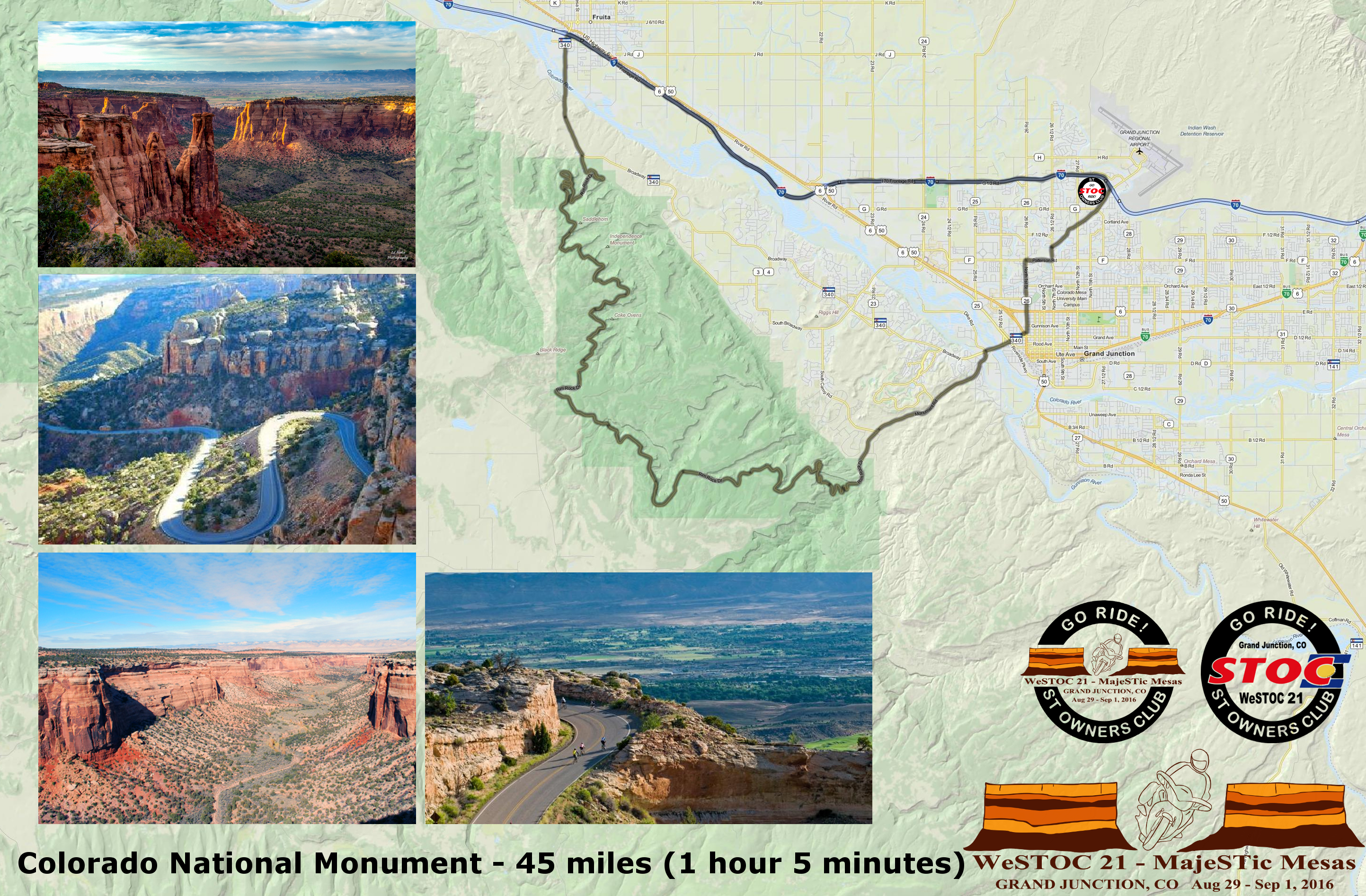
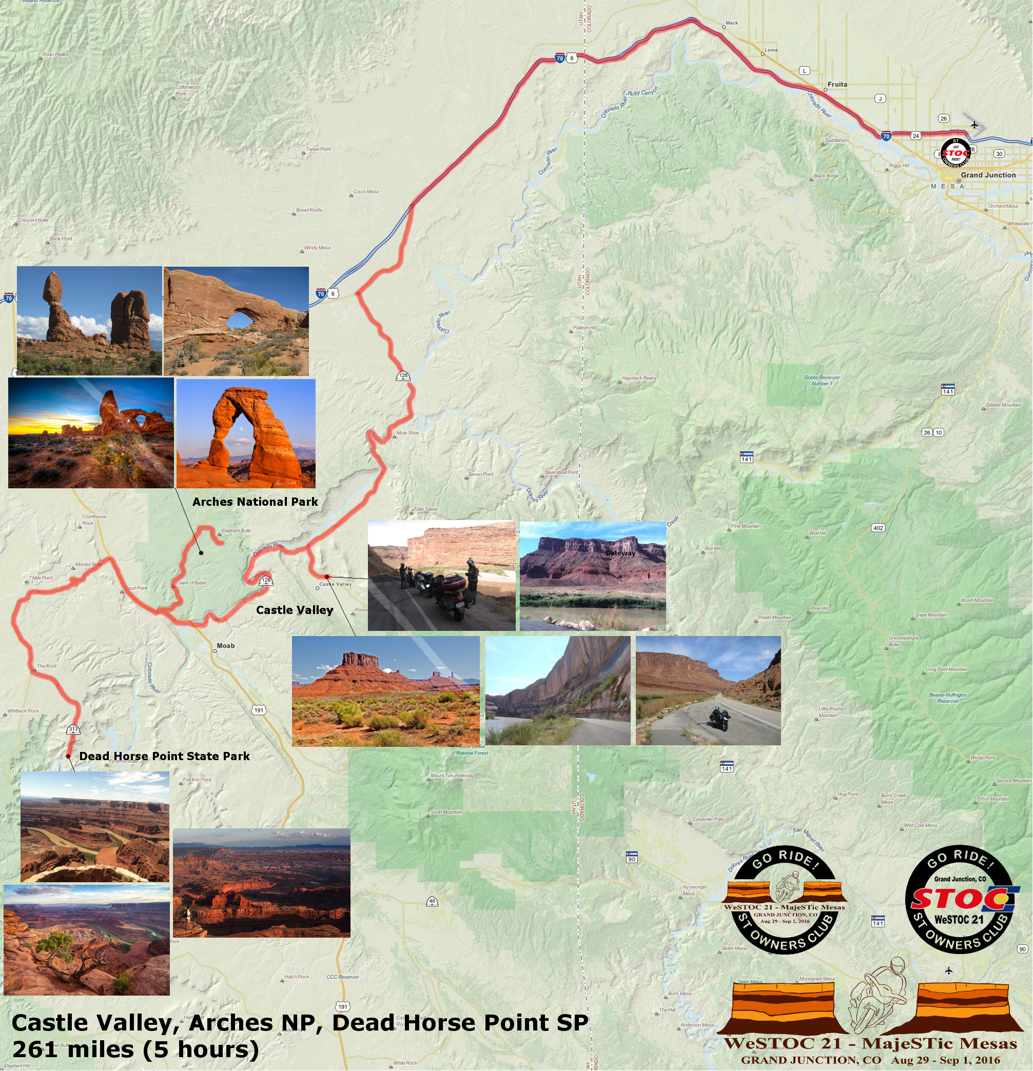
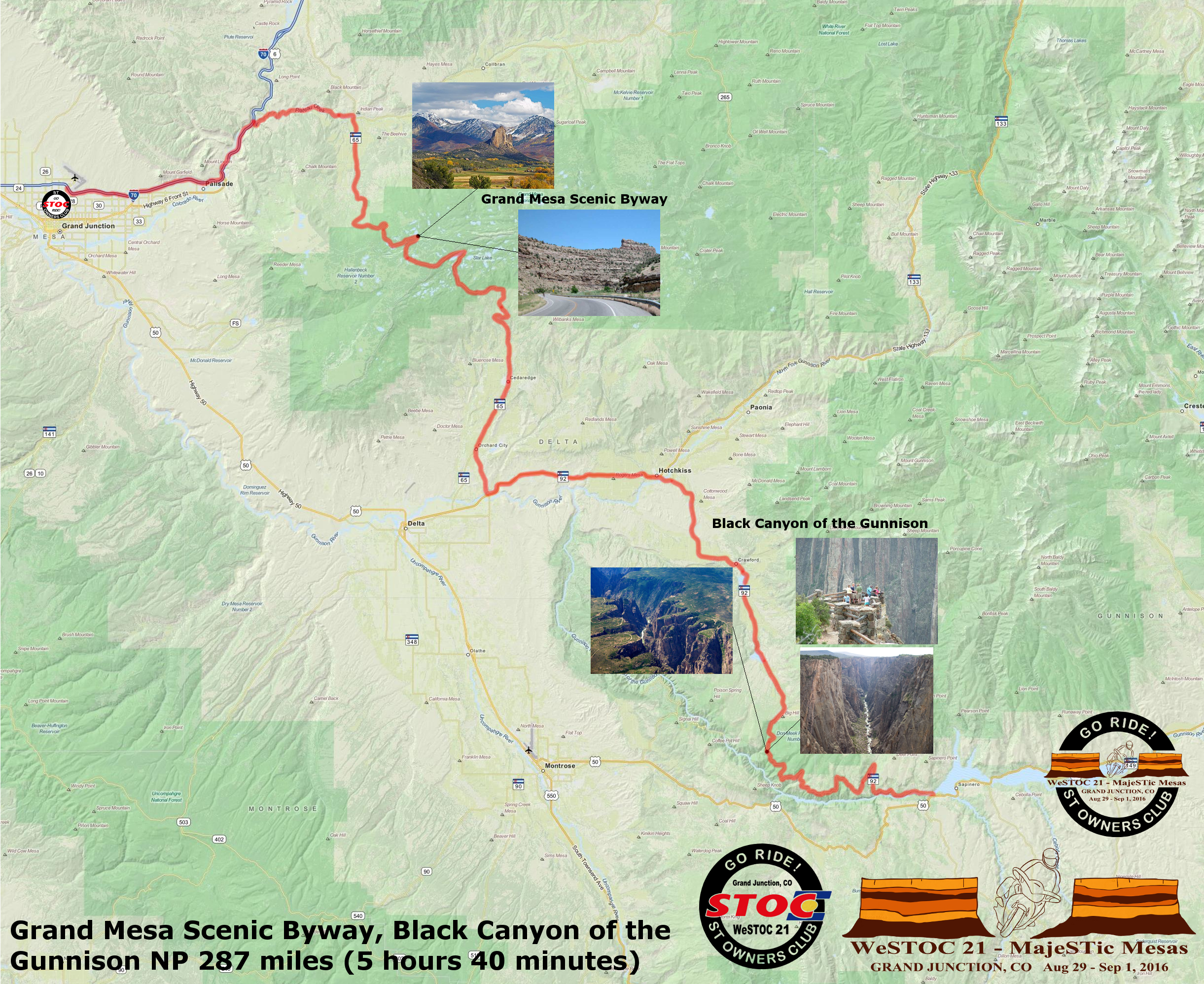
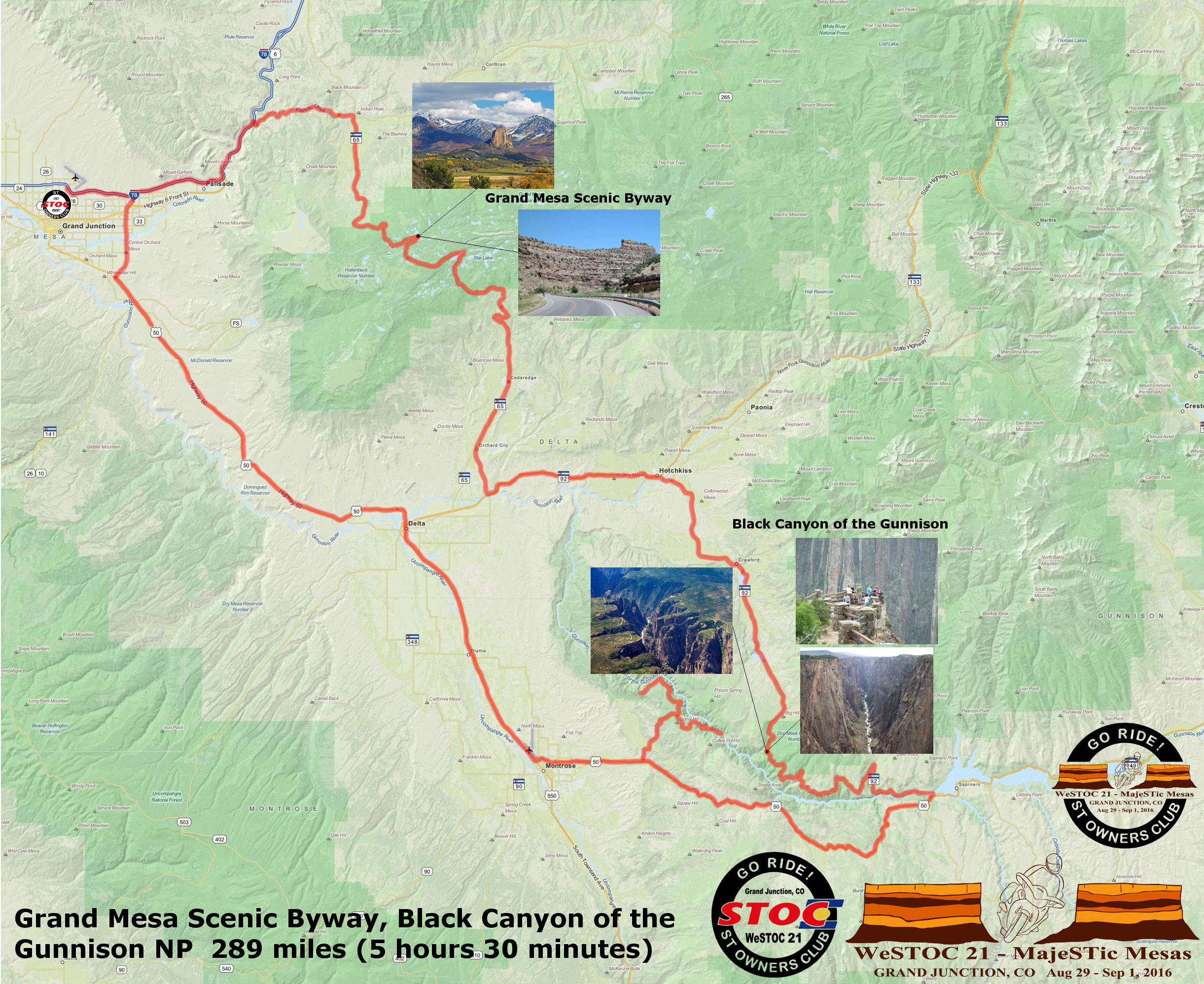
This ZIP includes both a Garmin GDB file, a generic GPX file and a KML file. All formats include routes and waypoints for restaurants, viewpoints and other points of interest. JPG maps of the routes show below are also included.
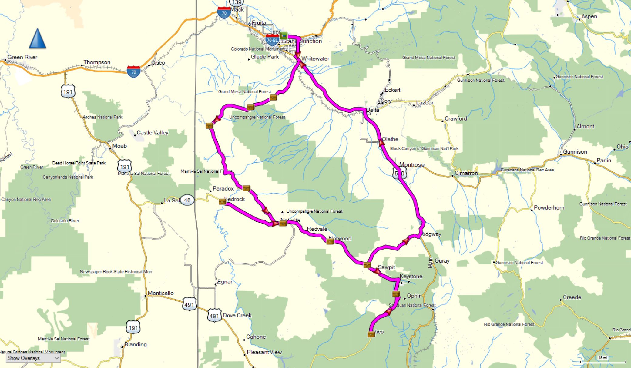
 A composite of all of the recommended rides
Click here for more info
Click here for more info
 Click here for more info
Click here for more info
Click here for more info

Click here for more info
Click here for more info

Click here for more info
 Click here for more info
Click here for more info
Click here for more info
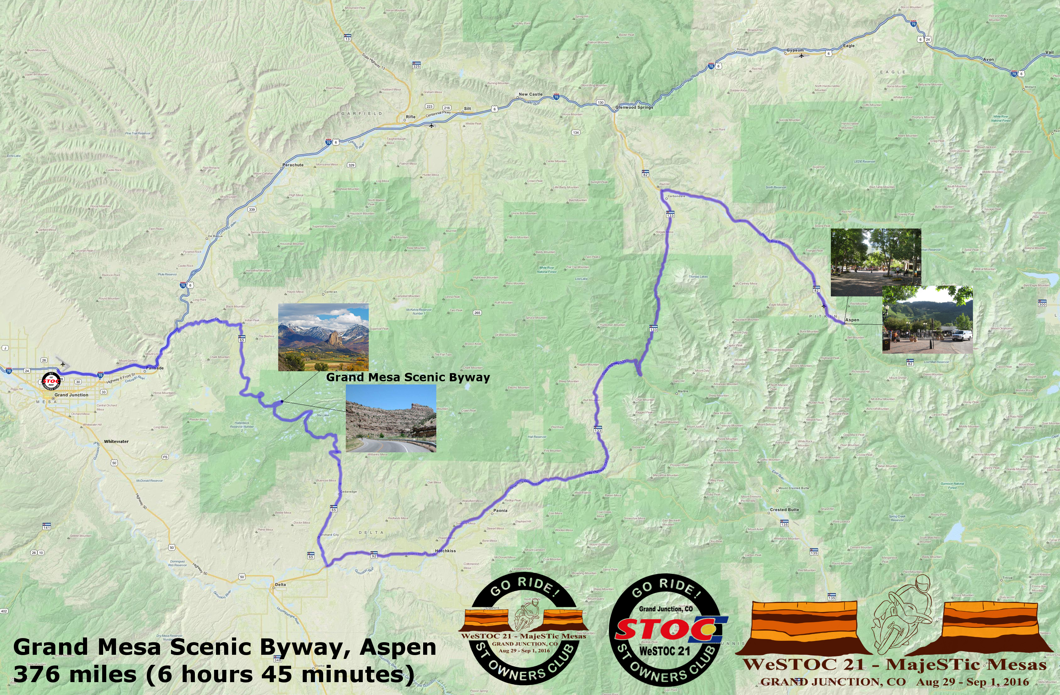
The Geocaching Ride
376 miles, 6 hours 20 minutes
10 Geocaches
 Click here for more info
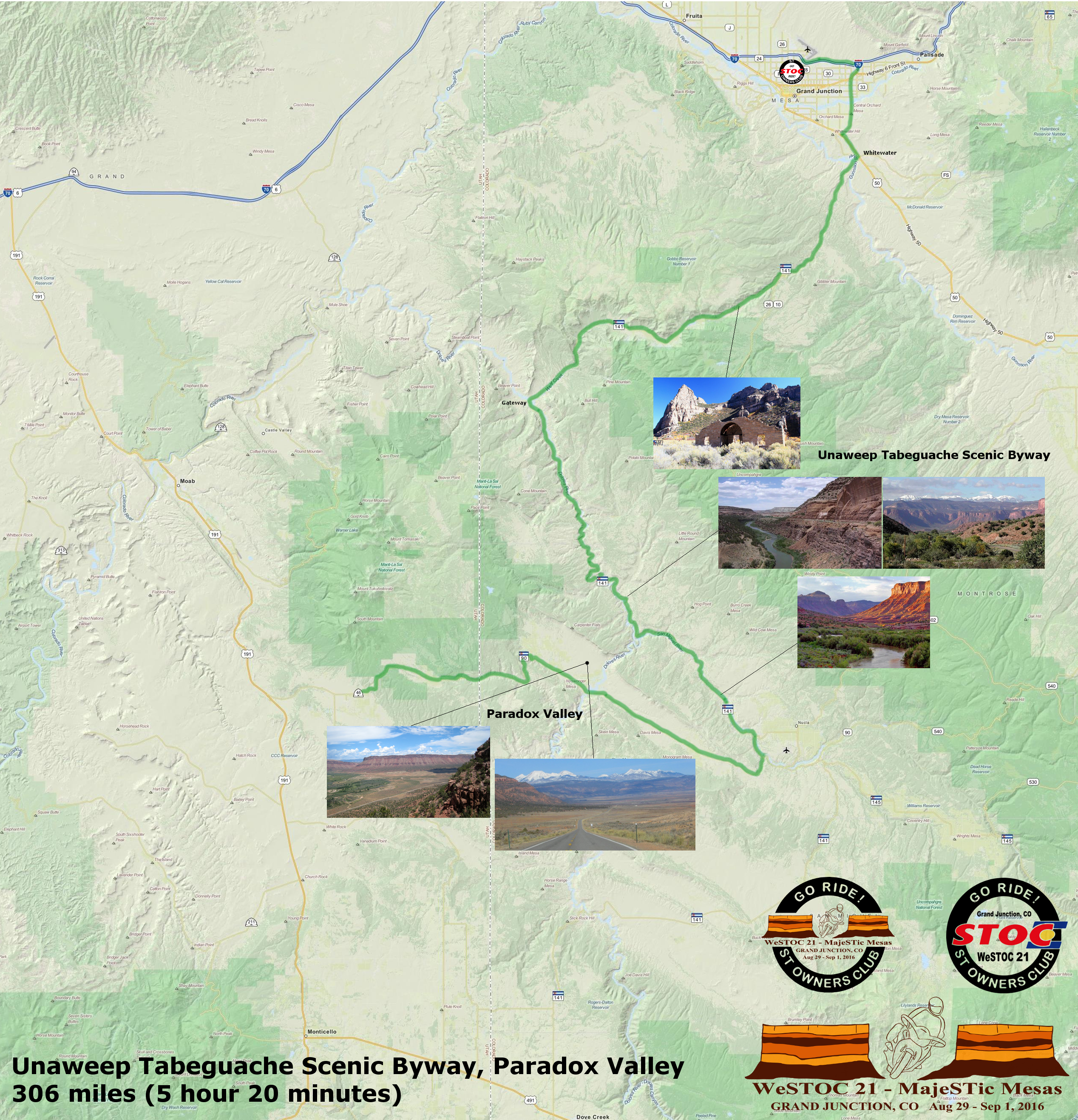
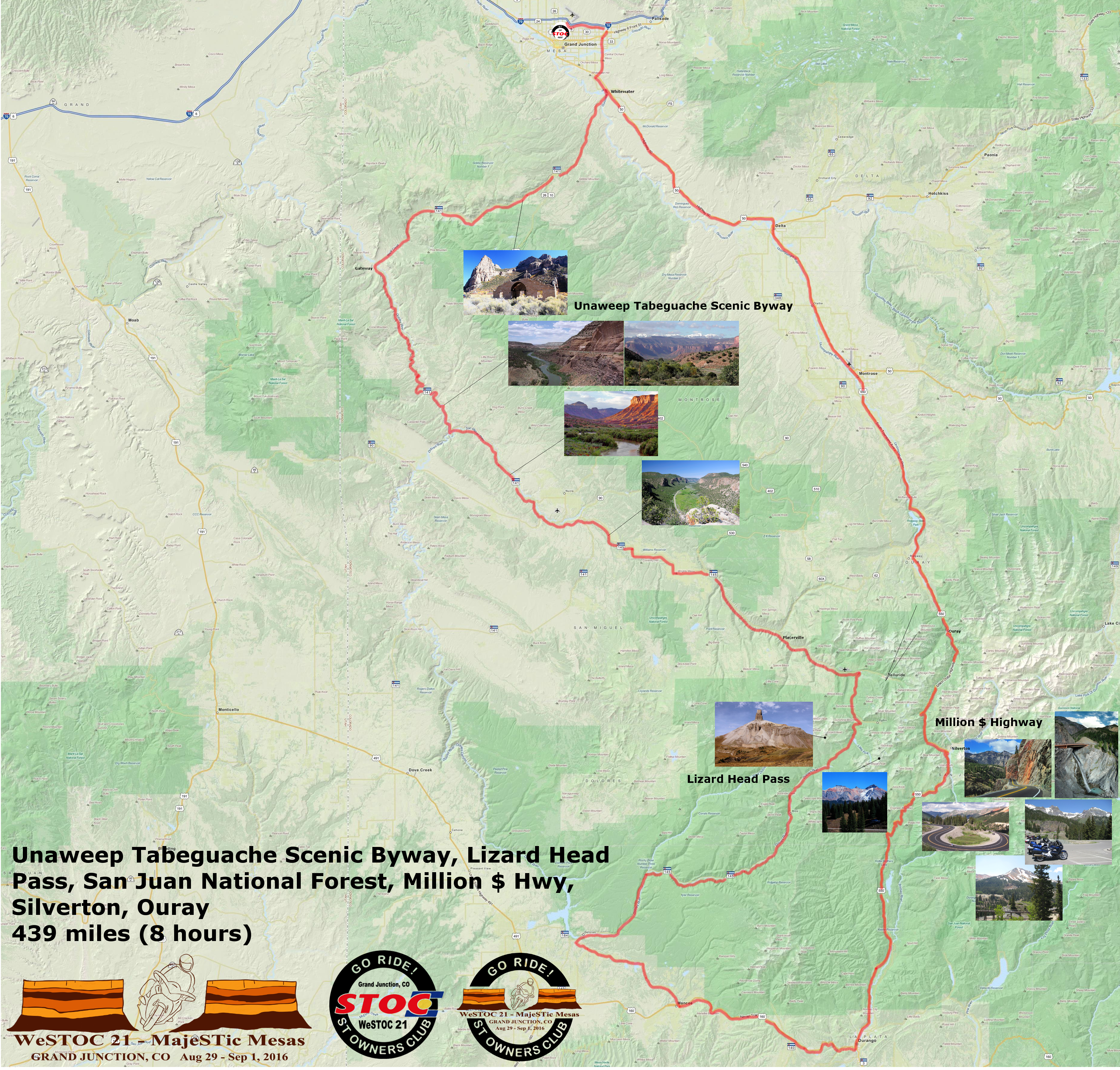
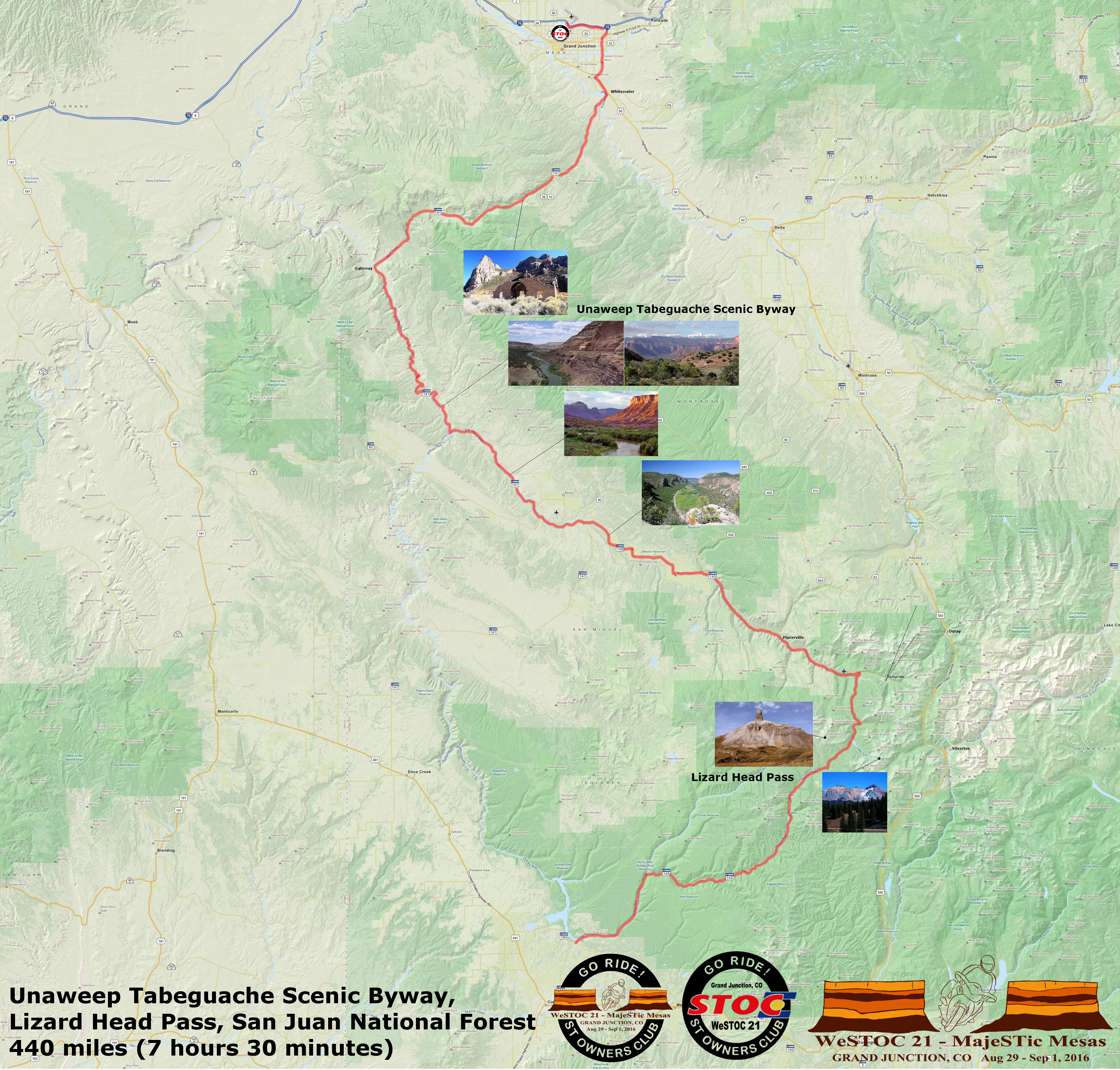
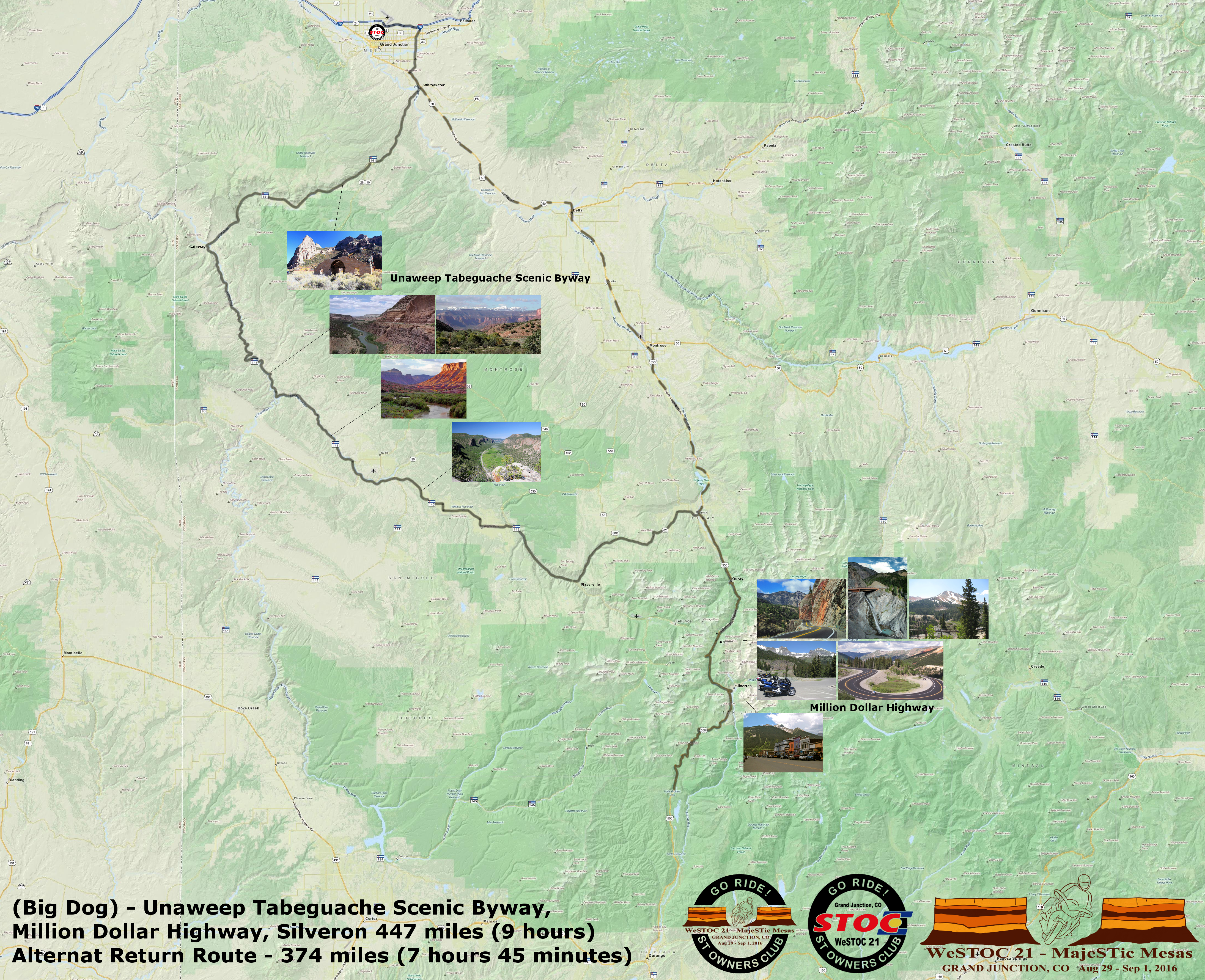
Unaweep-Tabeguache Scenic Byway specific sites
- Unaweep Tabeguache Byway Video –
Presented by The Interpretive Association of Western CO - RoadRUNNER’s Bucket List Roads: Unaweep-Tabeguache Scenic Byways
- Hanging flumes
- Gateway Auto Museum
For those who like gravel roads
Helpful documents for single and group riding
- ‘The Pace’ and ‘Pace Yourself’ by Nick Ienatsch are both good reads on riding techniques for single and group riding.
- QUICK TIPS: MSF’s Guide to Group Riding
- 8 Rules for Group Motorcycle Riding by esurance